16 Fuorn valley
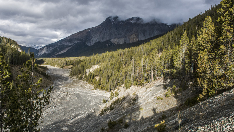
In the first section, from Il Fuorn to former P7, we see the impressive contrast between a humid alpine mixed forest and a dry mountain pine forest.
Few people choose to go the whole length of this walk as the second section runs alongside the main Pass dal Fuorn road, whose noise and fumes spoil the enjoyment of the natural environment.
Particularities
Free-flowing Fuorn stream in its varied and fascinating bed. Connection route.
Follow-up hikes
From Buffalora: Route 15
From Il Fuorn: Route 17, Route 18, reverse Routes 13, 14, 15

© Schweizerischer Nationalpark/Hans Lozza
© Schweizerischer Nationalpark/Hans Lozza
16 Fuorn valley
Difficulty: white-red-white / easy
Easy walk, ascending gently.
Arrival
Starting and end point can be reached by post bus (bus stops : Il Fuorn/P6, Buffalora/P10, other bus stop: Stabelchod/P8).
Season
Mai, June, July, August, September, OctoberRoute-information
- Length
- 5.50 km
- Altitude difference ascent
- 250 m
- Altitude difference descent
- 50 m
- Time required
- 1 hour 45 minutes
- Level technique
- Easy
- Level condition
- Easy
Arrival
- Starting point
- Il Fuorn (Altitude: 1794 m)
- Arrival by public transport (stop/station)
- Il Fuorn P6 Timetable SBB
- Destination
- Buffalora (Altitude: 1967 m)
- Arrival by public transport (stop/station)
- Buffalora P10 Timetable SBB
Infrastructure
Il Fuorn: www.ilfuorn.ch
- Playground
The offer is suitable for
- Adults
- Children from 7-12 years
- Children >12 years
- 50+
- Families
- Groups
Contact
NationalparkzentrumUrtatsch 2
7530 Zernez
Telephone +41 (0)81 851 41 41
Mobile -
http://www.nationalparkzentrum.ch